
This is all about Sugaya Yakata Ruins you want to know.
Every information you get on this site will be from a credible source based on Japanese history (books for reference).
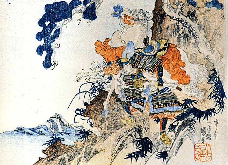
Ukiyo-e picture in Edo period written by Utagawa Kuniyoshi from Public Domain.
Profile : Sugaya Yakata Ruins
| Location | Ranzan-machi, Hiki District, Saitama Prefecture |
| Also known as | Sugaya Castle |
| Type of castle | Flatland |
| Mountain's name | ― |
| Elevation | ― |
| Condition | No main keep but other buildings |
| Designation | National Historic Sites |
| Year built | Unknown |
| Abolished | Unknown |
| Castle lord | Hatakeyama Clan (Hatakeyama Shigetada) |
| Refurbishment lord | Yamanouchi-Uesugi Clan |
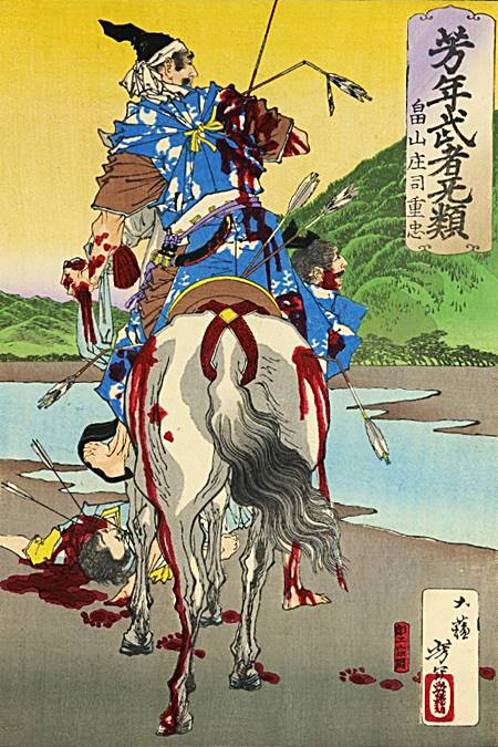
He was honored for his heroism during his lifetime, and was called "Samurai's Book" because of his innocent personality.
The family crest was originally created from the pattern that the emperor and the royal family put on the kimono, and the pattern was made into a fixed pattern, and the one attached to his own oxcart is said to be the beginning of the family crest. The warlords drew large crests on the flag-fingers, used to distinguish enemy views on the battlefield, and used by the generals to determine which warlords were active and how much.
Sugaya Yakata admission
admission fee : 100yen (Adult) 50yen(High school students) for free under junior high ※Saitama Prefectural Ranzan Historical Site Museum
admission time : am9-pm4:30
closing period : Monday (open on public holidays) Dec29-Jan3 reference official site
Sugaya Yakata Google Map
Sugaya Yakata Images
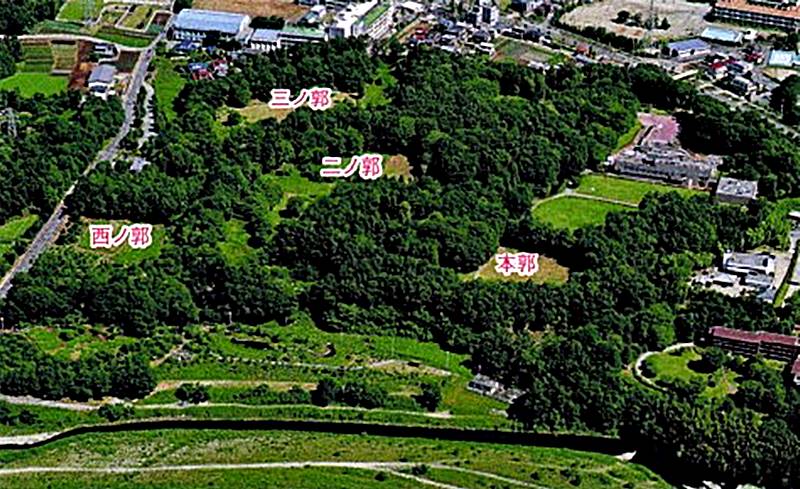
It was a castle built on a plateau on the north side of the confluence of the Toki and Tsuki rivers, and the Kamakura Kaidō passed nearby. The main building was located slightly south of the center, and Nino-Kuruwa and Sanno-Kuruwa were located on the north side of the main building, and the defense was strengthened with earthworks and trench. The main enclosure retains the remnants of a medieval single-walled castle, but it also has the characteristics of a flatland type castle with wide Kuruwas, the large scale of the earthworks, and the fact that they have horizontal Yokoyagakari (shooting point with arrows).
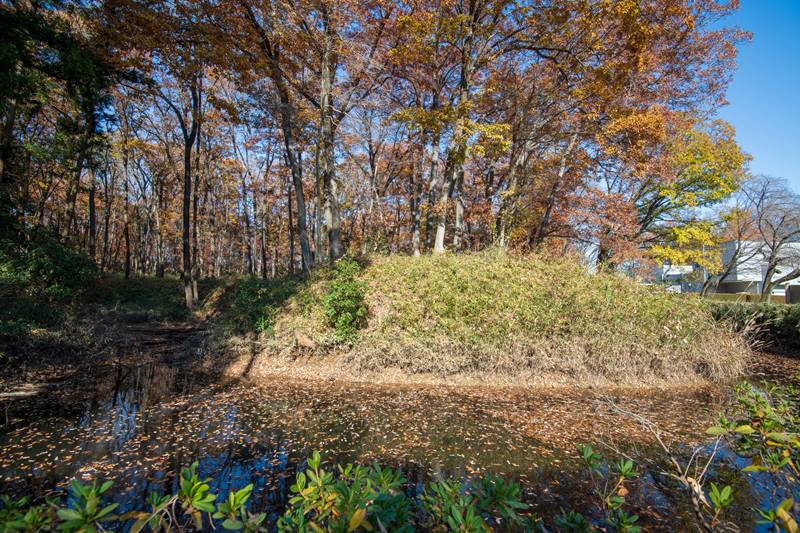
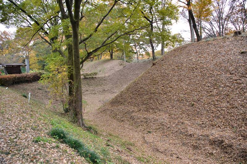
The horizontal Yokoyagakari is clear, the trench is deep and wide, and the earthworks are high.
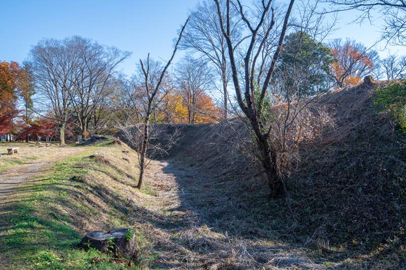
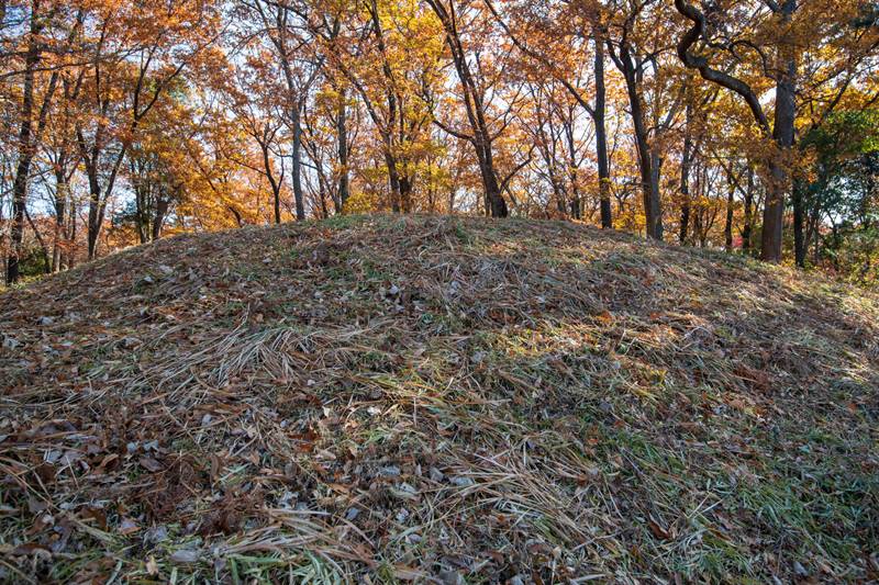
The current remains are the ruins of Sugaya Castle, which was expanded and renovated during the Warring States period. Since there is almost no damage due to development in later years, the earthworks and trench of the Warring States period are left in the original form.